Descripción
ENVIAR EMAIL
Geophysics
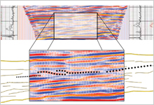
Borehole seismic linking of surface seismic and well data
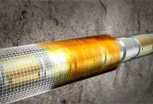
Borehole seismic surveys provide high-resolution, high-fidelity depth and velocity data for generating images and calibrating surface seismic data and models. LWD acquisition with real-time processing significantly reduces uncertainty ahead of the bit by up to several thousand feet.
Enhanced reservoir delineation, characterization, and monitoring
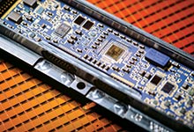
Key to the high data quality is the evolution from single-component sensors to Q-Technology point-receiver seismic hardware and software. Deploying these receivers in combination with improved sources and expert multidisciplinary processing and interpretation delivers borehole seismic images and vertical seismic profiles (VSPs) at near- and cross-well scales that illuminate key reservoir features such as compartmentalization, faults, and imaging below salt.
Más información sobre este producto consulte en: https://www.slb.com/services/characterization/geophysics.aspx